Engineering Services
-
Evaluation method of engineering geophysics and pile integrity test
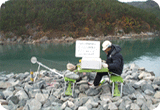
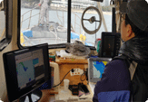
The foundation inspection is very important at very big construction field. It can be expected direct effect such as reduction of work necessary time and cost from design to exact geological inspection. It's very urgent and useful to safety valuation within work period and safety guarantee of construction after work completion We would like to introduce the valuation method of all kinds of pile's integrity besides cast in place pile and various engineering geophysics at engineering field and describe the application field and effect.
-
Outline of survey
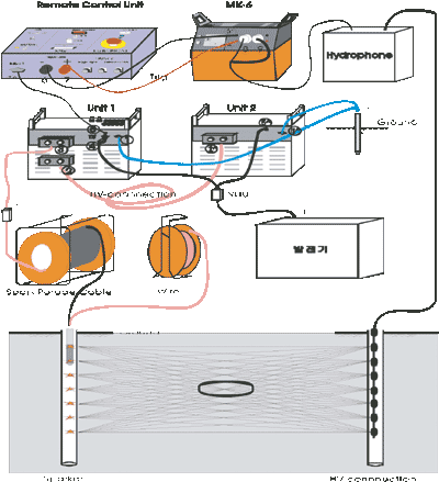
Seismic tomography is the technique which shows the earth through images using seismic data. This technique has long been used to get subsurface images. Seismic tomography is also called CAT or CT scanning since it is greatly assisted by computers. In geophysical exploration, ST is geo-tomography which is a way to obtain images of electromagnetic, amplitude and absorption.
-
Applications
Searching for intervening rock or bordering rock
Seismic velocity of the rock
Underground detection
Measurement of ground young's module
Safety assessment to environment, civil engineering and industrial structure
Measurement of energy-source position
Ground assessment for constructing waste site and civil engineering works
-
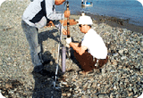
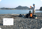
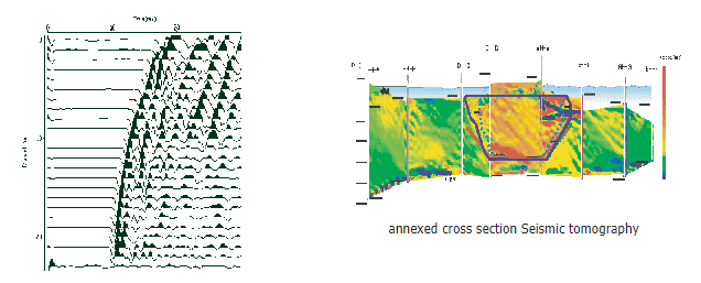
Example of Seismic Tomography
Seismic tomography is used to measure layer division, geological structure, the location and condition of crushed and poor ground, the presence of existing of underground cavities, the distribution of underground cavities and the seismic velocity of the rock.
-
Outline of survey
Electrical resistivity surveys involve the measurement of the apparent resistivity of soils and rocks as a function of depth or position. The resistivity of soils is a complicated function of porosity, permeability, ionic content of the pore fluids, and clay mineralization. The most common electrical methods used in hydrogeologic and environmental investigations are vertical electrical soundings (resistivity soundings) and resistivity profiling.
-
Applications
Soil survey of site in construction and engineering site
Formation evaluation
Measuring a bed rock depth
Searching a fault zone
Whether the area is blessed with natural underground water or not
Leak detection of a dam
Cavity detection of lime stone zone
Environmental impact survey in plant sites
Monitoring of pollution spread and pollution's detection by waste in reclaiming
-
Example of Eletrical Resistivity Survey
The figure below shows an example of Electrical resistivity survey. As the soil around this area has caved in, this survey was carried out in order to find the most appropriate way to reinforce the soil. As a result of this survey, a zone where the soil was caving in and ground water was flooding was discovered. This was verified by the bore-hole survey. Electrical resistivity survey provides important data for structure safety through a part of its surveying process, the soil survey of the foundations on site.
::: Test Result of Electrical Resistivity Survey :::
-
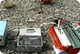
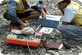
Outline of survey
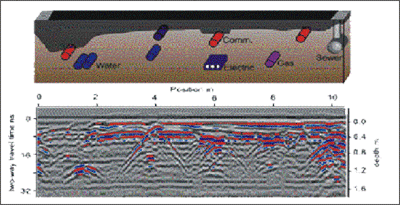
Ground-penetrating radar survey works by sending 25-1200MHz of radar waves into the soil as the instrument is dragged across the survey area. By measuring how long it takes for the radar signals to bounce back from the object to the receiver, and how many signals were absorbed, you can interpret information about what a buried object is made of, how deep the particular object is, and sometimes the stratigraphic layers of the archaeological deposits and the soil itself.
-
Applications
Surveying a water supply, sewerage, gas pipe, etc
Surveying a location of structure buried in the underground
Surveying a thickness of tunnel lining
Surveying a cavity of tunnel lining
Surveying a timbering condition
Surveying the construction effect of grouting
Surveying a thickness of road packed
Surveying the original ground or supplemental layer of low part
Surveying a condition of concrete bar or wire mesh
Void survey
Measuring a pile position under concrete
Measuring a bed rock depth
Structure of bed rock or fault zone
Cave or cavity detection
Surveying the archaeological remains buried
-
Example of Ground Penetrating Radar Survey
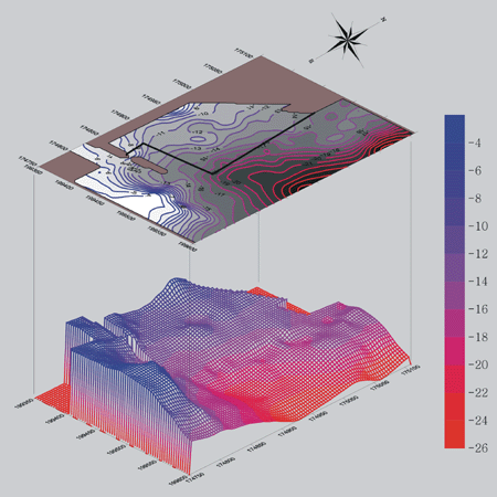
The figure is an example of the electrical resistivity survey results. This exploration area is an area where the surrounding soil collapsed due to a large amount of rainfall, and the basic ground survey was conducted for the purpose of seeking repair and reinforcement plans through geological surveys in the lower part of the basement. As a result of this exploration, the part where the sediment collapsed and the zone predicted as the groundwater flow zone in the lower ground were found, and this was reconfirmed through drilling investigation. The electrical resistivity survey can be used as important data for securing the safety of the upper structure through this basic ground survey.
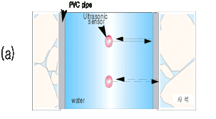
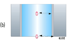
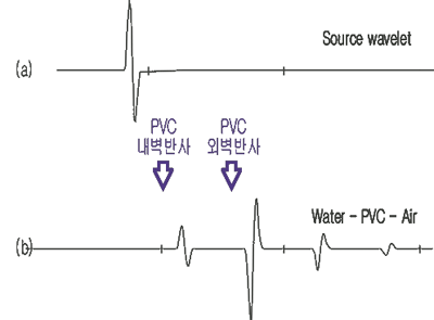
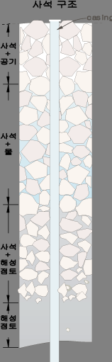
This is an example of soil structure in a river. This survey can measure the depth of the bed rock and the river as shown in the picture above.
Ground Penetrating Radar Survey makes it possible to survey the location of buried waste in detail as shown in the picture above.
-
Outline of survey
Acoustic tools use sound to measure various properties of a well. The Sonic Tool is used in open boreholes (uncased wells) often to calculate porosity, measure relative formation hardness, and see water table, or show fractures.
-
Applications
Soil survey of site of civil engineering works
- Calculating an amount of dead stone and distribution condition in bay, and boundary survey
- Calculating an amount of dead stone dropped in the coast
- Land subsidence and geological survey
- Secure the location of an atomic power station
- Soil survey of site of waste storageBore-hole survey and cavity survey
- Casing joint survey
- Poor part survey in hole
- Underground artificial or natural cavity survey
- Measuring cavity deposit condition
- Recording a photo before discovering remains in undergroundSafety Diagnosis
Safety inspection of the bridge
- Survey in advance before inputting a bore-hole equipment
- Corrosion survey of old pipe. -
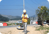
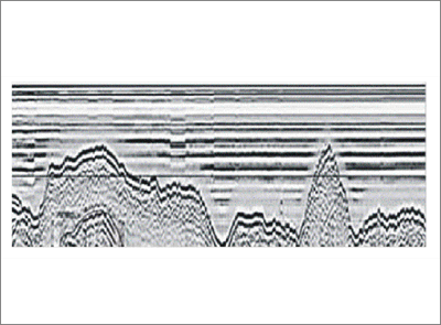
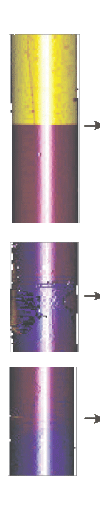
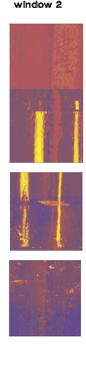
Example of Acoustic Televiewer Image Logging
-
Outline of survey
The common use of seismic reflections involves layered geologic units, It is important to note that the technique can also be used to search anomalies such as isolated sand or clay lenses and cavities. The seismic results obtained can be used to develop 3D structural models.
-
Applications
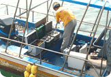
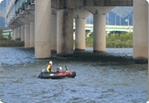
Inspection geology for engineering works in the ocean
Soil survey of site of foundation for safety inspection in the ocean
Remain's discovery under water by geophysical survey
Assuming the position of buried material through a diffracted wave
Searching buried material in the ocean
Survey of shallow water area Survey of shallow water area
-
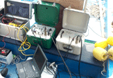
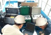
Expected Effect of Ocean Seismic Reflection Survey
Conventional bore-hole survey has limitations in its data when it is used to design safety inspection plans for large structures. Consequently, the bore-hole survey has problems such as high cost and unreliableness structure safety. If we apply Ocean Seismic Reflection survey to ocean engineering works at the beginning of the work, however, we will be able to design the structure more accurately and to make it sure that the structure is safe. Ocean Seismic Survey is expected to become very popular and it is relatively simpler than the bore-hole survey and more reliable as well.
-
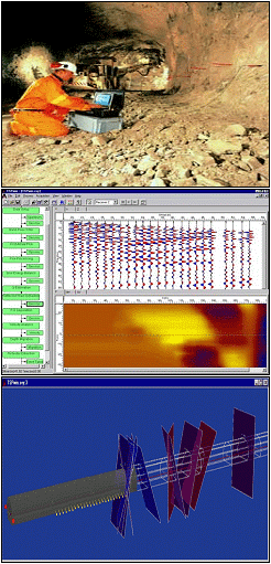
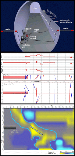
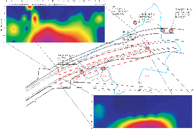
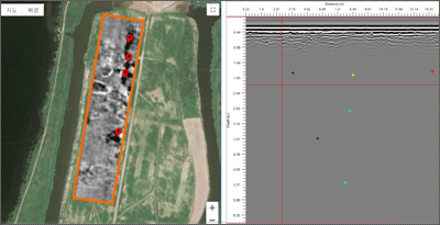
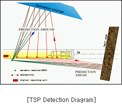
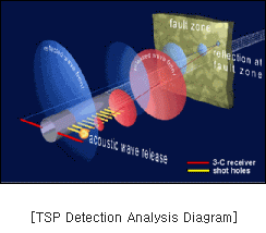
As 3D-TSP Detection is ahead of the tunnel face Prediction method by using elastic wave characteristics and can be detected discontinuities of geological boundary planes and geological structure zone (fault, fracture) with being ahead of the face within 200m from face by using waves(P wave, S wave) produced gradually from a lot of shot point & receiver point. In other words, this is the ground detecting method which can be produced by analyzing individually or totally a series of seismic and time records with differentiating the distance shot point and receiver point as to the information of ground layer structure & dynamic characteristics such as elastic characteristics (elastic coefficient, Poisson's ratio, etc) of tunnel ground surrounded and the spatial location & slope of discontinuities such as fault fracture, the relative strength changes of ground which is placed in the front and rear of boundary planes and the boundary planes of different ground layer distributed in the ahead of the tunnel face& surroundings.
※ Ahead of the tunnel face ground detecting Method
1. Ground Radar Research(GPR)
2. Forward Parallel Boring
3. Seismic wave Detection (Reflecting wave Seismic wave Detection, TSP Detection)
There are other ground detecting methods, Vertical Drilling, Electric anti-resistance detection, Seismic wave Detection which can be performed in the tunnel surface.
-
3D-TSP Outline
We can understand fault zone and estimate whether the existence of ground discontinuities within 200m in the ahead of the face, it's scale and the crossing angle of tunnel & direction in recording reflected wave from ground boundary plane(fault, fracture) by shot seismic in order from a lot of shot.
-
Features & Advantages
Estimating Range : 200M
Detecting Time : 1.5 Hrs
Excellent&Correct Estimation of potential risk area considering similar detecting range
The Minimum of Operating Equipment stop
Reliable support type & choice of supplementary method
-
Expected Effects
Possible preliminary measure at fault & fracture
Diminishing the loss of working cost according to operation stop
Reducing working period & cost by producing optimum support range at risk area
-
General Analysis for the choice of supplementary construction method
We should generally decide in consideration of this 3D-TSP result, the existent drilling result , FEM analysis result, the shape of geographical features etc.
-
Equipment
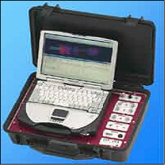
::: TSP 203 Seismic recording unt :::
· 12 channel
· 24 bit AD conversion
· Record length 451ms to 1808 ms
· sampling interval 62.5/125ms
· Dynamic range of 120 db
· on-board battery powered (>3.5hrs)
· 12,1 kg weight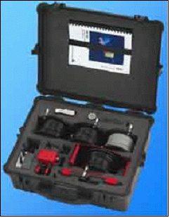
::: Water-tight accessory box :::
· electronic inclinometer
· trigger box
· cable drum holder
· cables
· charger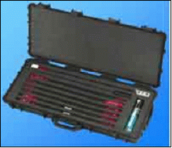
::: TSP-203 Receiver units :::
· Two triaxial ultra sensitive seismic receiver units divided into three parts
· Sensitivity 1000 mV/g ± 5 %
· Frequency range 0,5 - 5000 Hz
· lubricant spray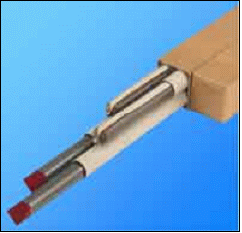
::: Consumable material :::
· Four high precision steel casings of 2.0 m length
· two-compound epoxy cartridges, 5 min. reaction time
::: TSPwin softwave :::
· 3-component seismic Data Acquisition
· 3-component seismic Wave Field Processing
· P- and S-wave graphical event presentation in tunnel geometry
· 2D &3D Result Display
· Rock mechanical parameter output
· Documentation output